Satellite data harnessed to track oil and gas methane emissions
French analytics company teams with European Space Agency to help identify sources of large greenhouse gas leaks
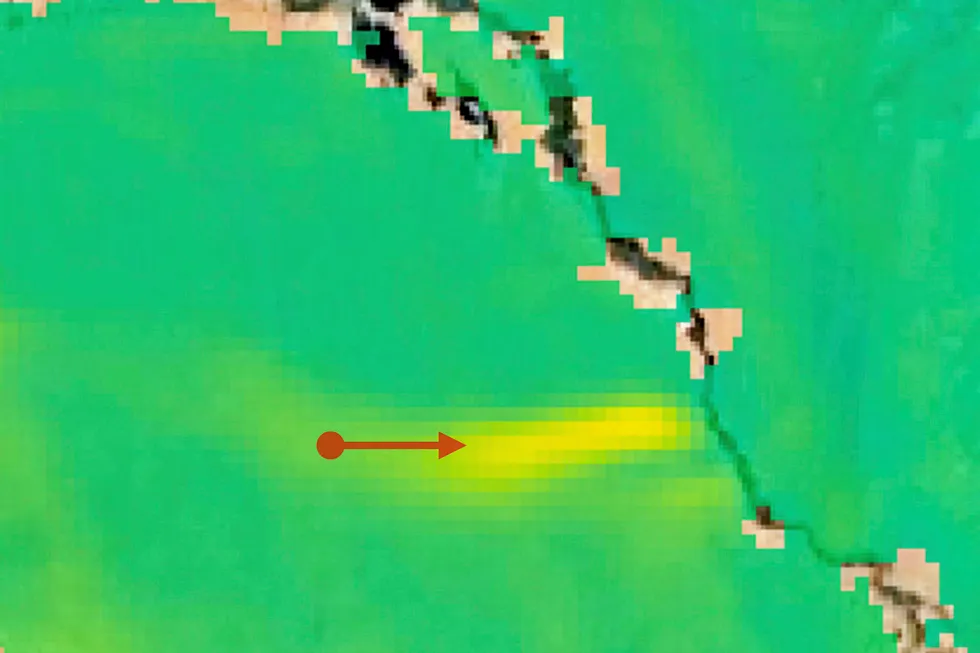
French analytics company teams with European Space Agency to help identify sources of large greenhouse gas leaks